
Residential remodel using laser scan
As a class we scanned a house and reconfigured a portion of it to add an in-law suite and car port. After creating an as built model, and redesigning it we used it for virtual reality and augmented reality to show the client what they were getting.
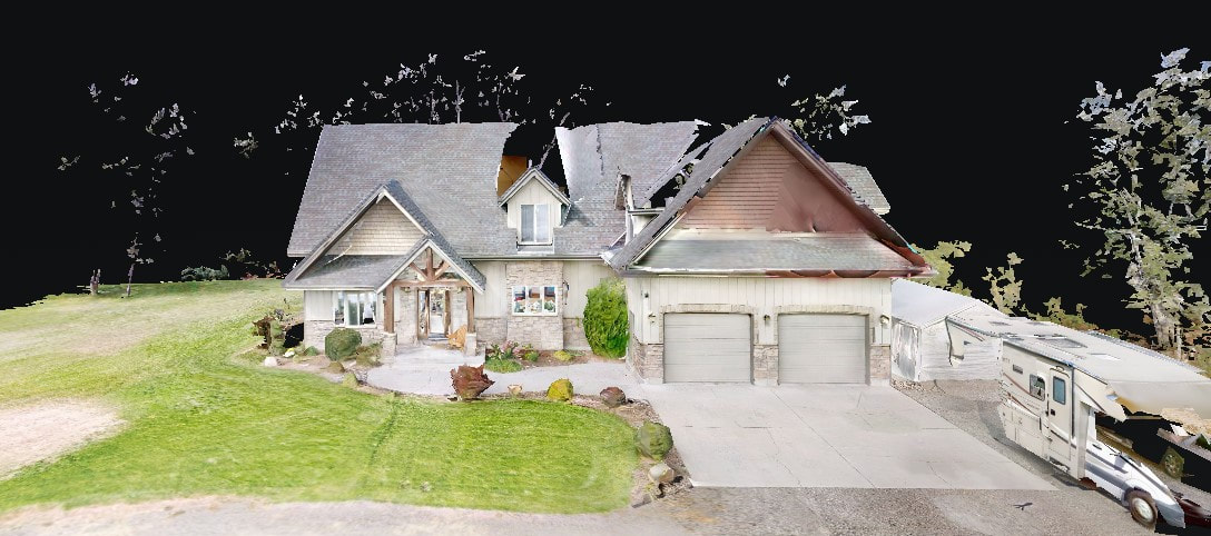
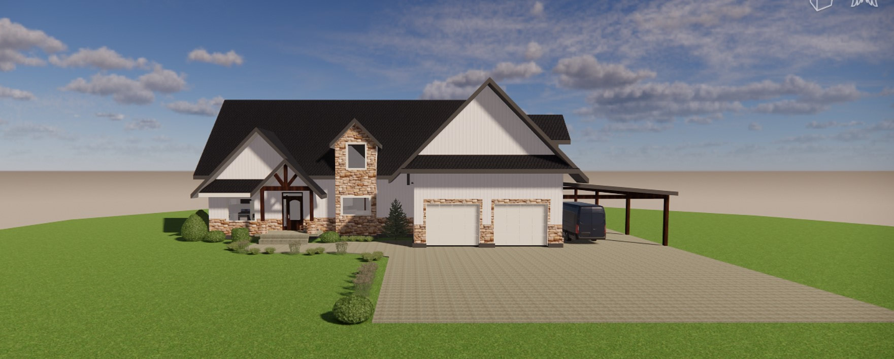
The first photo is the scan we received. The second photo is my exterior model of the existing house.
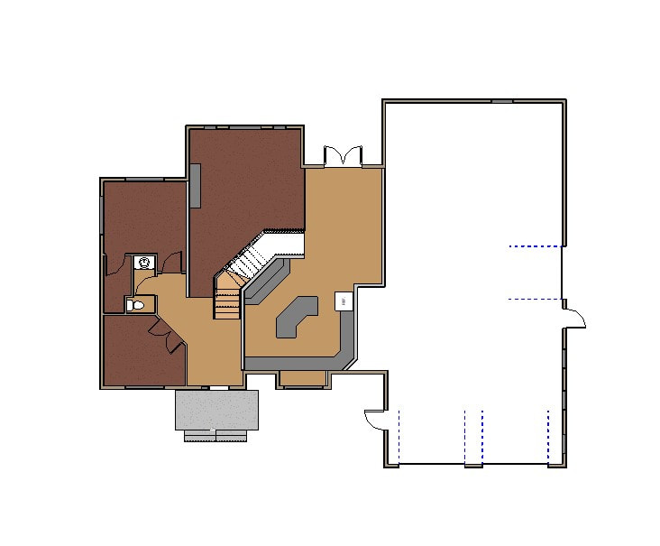

On the left is the original first floor plan. On the right is the revised floor plan to include the in-law suite and the car port.
Hidden Valley Subdivision
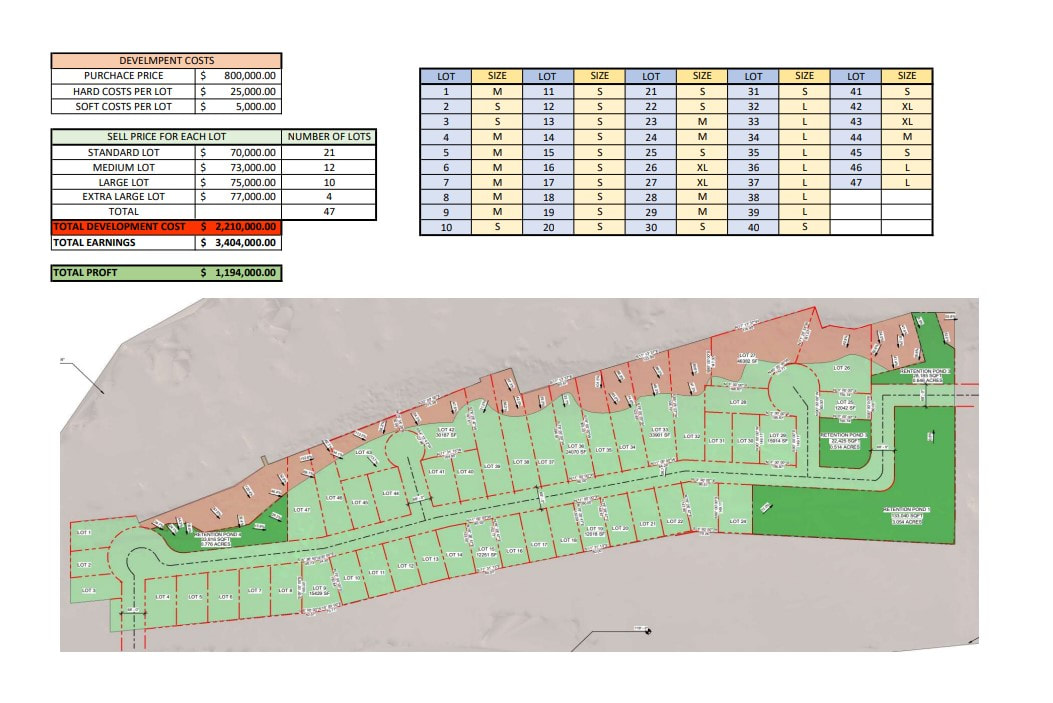
Our task for this project was to scan a plot of land with a drone, take that scan and see how many residential lots could be built. This piece of land has some unbuildable areas due to steep slopes (shown in red).
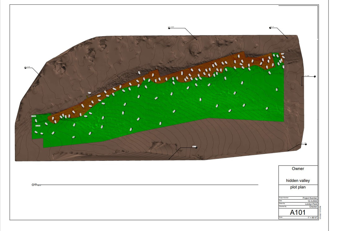
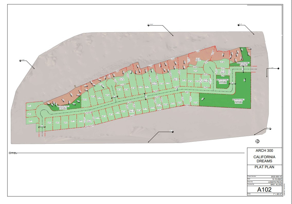
On the right is the modeled land from the drone scan with the property of concern in green with the unbuildable areas is red. On the left is the proposed subdivision layout using LDR1 standards with 5 acres of retention ponds shown in dark green.
The last part of this project was to estimate how much a developer would make if he chose to develop this land as LDR1.
The last part of this project was to estimate how much a developer would make if he chose to develop this land as LDR1.
3D Printing
Throughout the semester we had the task of modeling two Latter-Day saint temples. The first one was our choice and the second was the Nauvoo Illinois temple. After modeling, we were required to 3D print the temples.
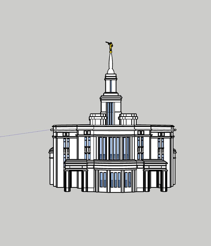
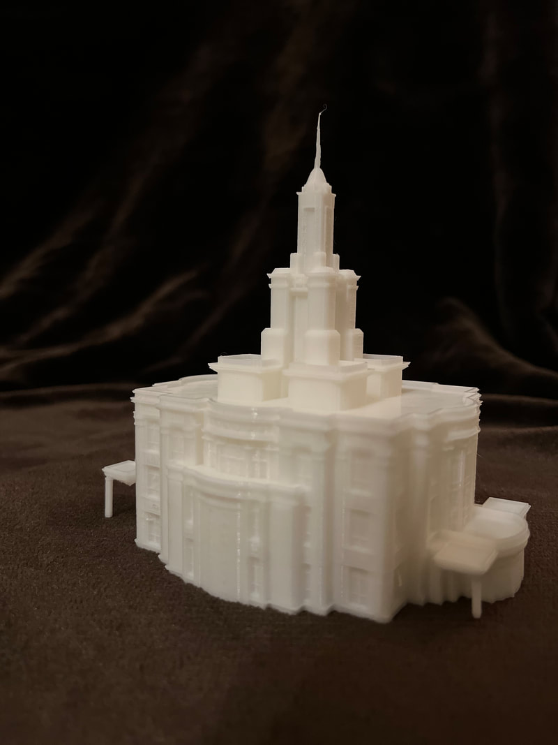
Payson Utah temple
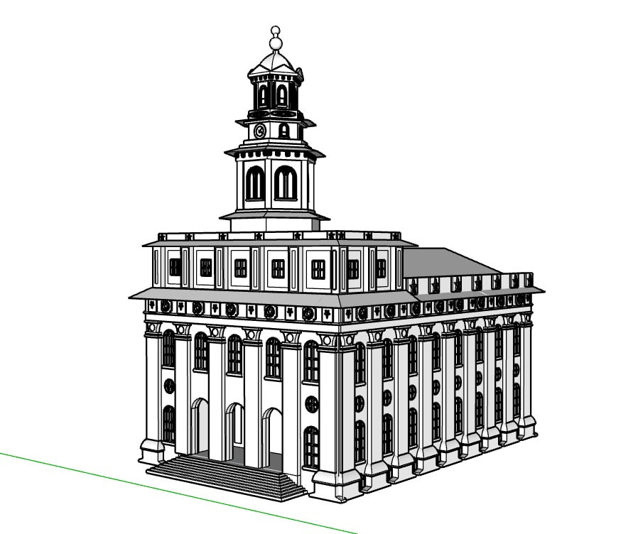
Due to some technical difficulties I was not able to print the 3D model for the Nauvoo temple.
